Managing groundwater in a shifting climate: The TOPSOIL project
DOI reference: 10.1080/13673882.2020.00001064
By Ilke Borowski-Maaser, CEO of Interessen Im Fluss, Peter Nailon, Wear Rivers Trust and Jesper Bjergsted Pedersen, Aarhus University
Although climate disruption is almost certain, local effects of climate change – storms, floods and droughts – are hard to predict. Underground aquifers holding immense amounts of groundwater play a hidden but crucial part in this process. Through better predictions and cooperation with local stakeholders, TOPSOIL helps to future-proof groundwater management in the North Sea Region.
Groundwater is an invisible resource of outmost importance – in many European regions more than 90% of the drinking water originates from groundwater. Climate change will impact groundwater, but exactly how is poorly understood.
To build the knowledge base for soil and groundwater management, the Interreg North Sea Region project TOPSOIL has developed and tested new local and regional approaches. In contrast to many modelling projects, TOPSOIL always works in close cooperation with stakeholders and groundwater managers. Coupled with a high sensitivity toward governance issues, the local project pilots aim “to get things done” and implement solutions.
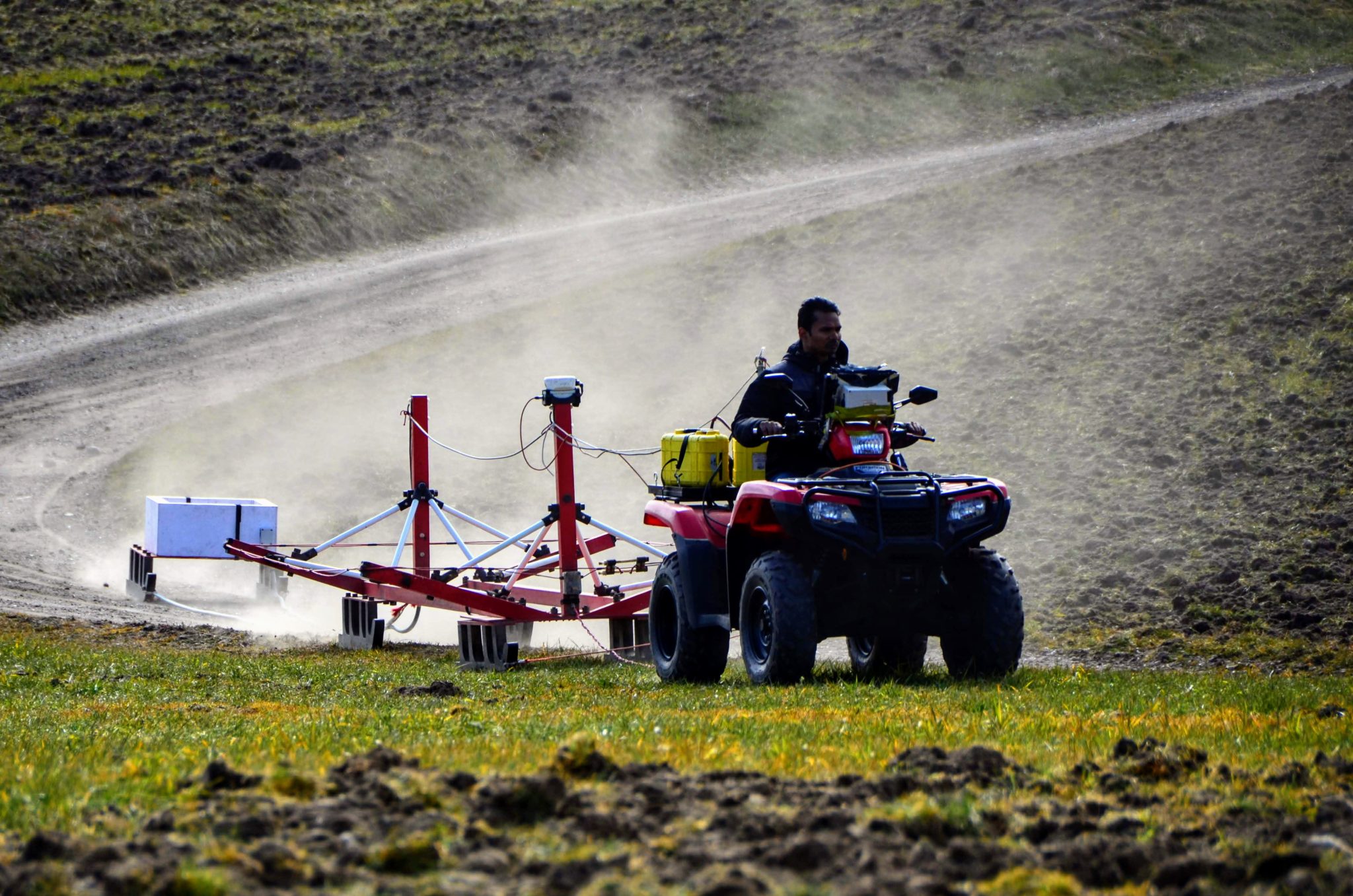
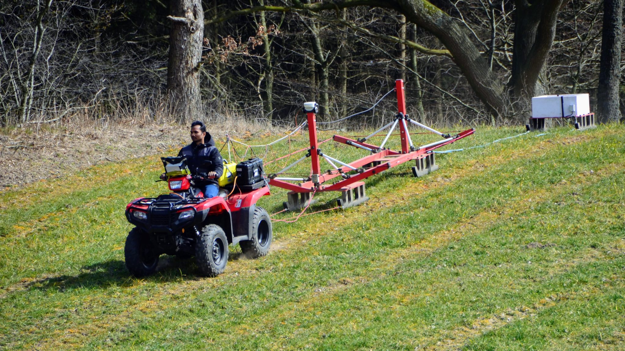
The tTEM system in action. © HydroGeophysics Group Aarhus University
This approach has led to highly relevant results in six major working areas:
- Groundwater flooding in towns and agricultural areas.
- Saltwater intrusion into freshwater reserves.
- Need for a groundwater buffer.
- Management of soil conditions.
- Capacity to break down hazardous substances.
- Balancing new seasonal availability of and demand for groundwater.
In this article, we present two examples of project-interventions, which illustrate the complexity of climate adaptation in groundwater management: An innovative geophysical method to generating crucial data and a cooperative approach involving farmers in groundwater protection.
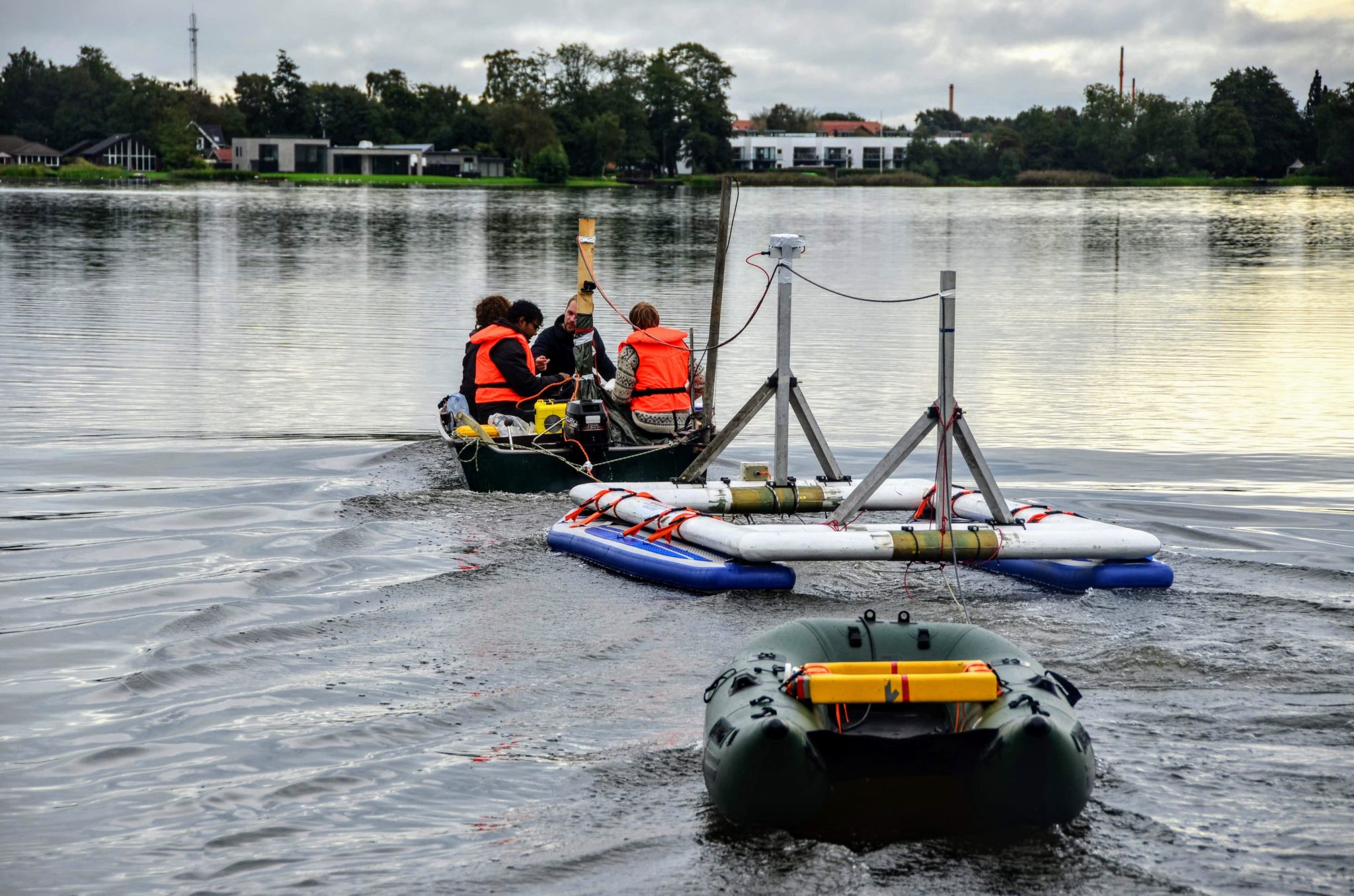
The FloaTEM system. The transmitter coil is mounted on two SUP-boards and the receiver coil is dragged after in a small rubber boat. The system as a whole is pulled by a small motor boat. © HydroGeophysics Group Aarhus University
Precision mapping yields surprising information
Generating reliable models requires data of good quality and quantity. TOPSOIL has tested the ground-based transient electromagnetic method tTEM, which has been in development since 2015.
The tTEM method produces 3D images of the near surface soil (at depths between 0 and 70 m) cost-effectively by towing the instruments with an ATV enabling mapping speeds of 20 km/h. The images provide many insights into the different sand and clay layers – information which the groundwater managers need in order to put in place efficient measures for water buffering, abstraction or dealing with pollutants.
The TOPSOIL partnership takes a coordinated approach to upscaling the method with regard to specific groundwater issues such as the interface between saltwater and freshwater, mapping water-filled fractures and understanding the nature of the underground in 3D.
For example, the flood-prone Danish city of Sunds (about 130km south Aalborg) has conducted tTEM mapping on land and in a lake to understand the hydrological system in order to avoid a rising ground water table in and around the town of Sunds. The water table is expected to rise even more in connection with the renovation of the city’s sewer system combined with increased precipitation due to climate change.
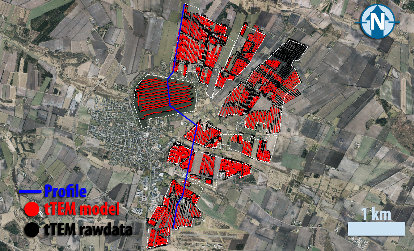
Geological mapping to understand the hydrological system, understand and avoid a rising ground water table in and around the town of Sunds. © HydroGeophysics Group Aarhus University
Before project start, knowledge of the area’s geology was rather limited. The location of Sunds on an outwash plain from the last ice age indicated a simple near-surface geology, but the geophysical mapping has shown that the subsurface is a lot more complex than anticipated. Below the upper 10-20 m of glacial sand, glacially deformed clay layers appear interchanging with Miocene (pre-Ice age) sand. A thick gyttja (mud rich in organic matter) deposit is found at depths between 10-20 m under parts of Sunds Lake.
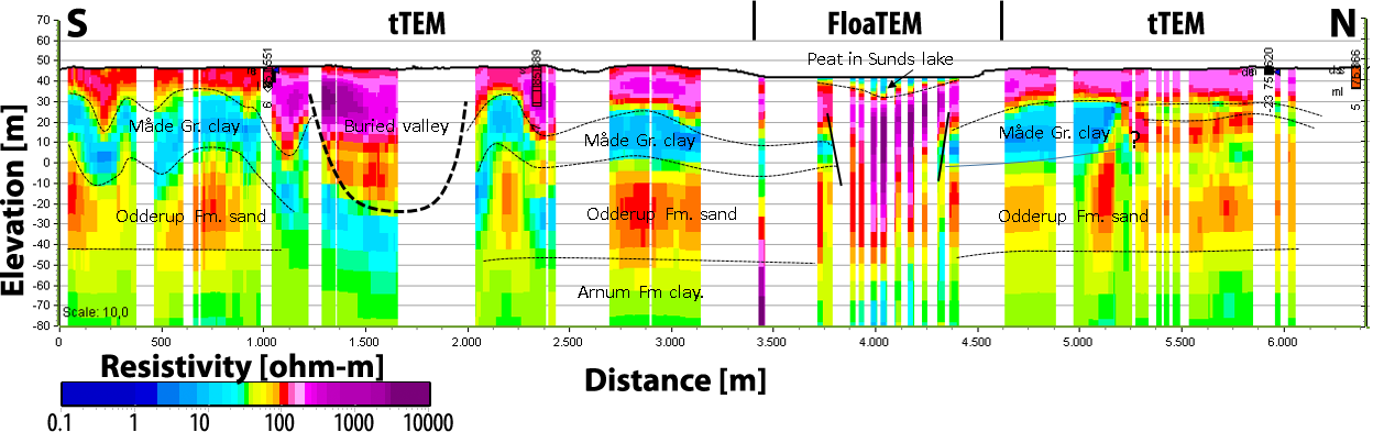
More than a sandbox. Depth profiles show the diversity of soil. © HydroGeophysics Group Aarhus University & Geological survey of Denmark and Grennland
The clay and gytje deposits are important to the hydrological cycle. The new knowledge will greatly qualify and enable climate proofing of the town and surrounding farmland.
Increasing farmers’ benefit of groundwater protection
A key interface in groundwater management is the one between farmers and drinking water providers. With changed temperature and precipitation due to climate change, this will gain further importance, since e.g. degradation or transport processes in soil will change as well and may accelerate nitrate leaching. Soil management is thus the core of sustainable groundwater management and climate adaptation, partly because nitrate is a ubiquitous problem in the North Sea Region. Nitrate is the most common contaminant in drinking water and is known to cause health issues such as “blue baby syndrome.”
Applying the precautionary principle e.g. to limit nitrate leaching from agricultural land is among the most difficult challenges. It requires cooperation with farmers who are often squeezed between regulations and diminishing returns. TOPSOIL pilots are trialling new approaches to facilitate such cooperation.
In the UK 1 pilot, the charity Wear Rivers Trust coordinated roll-out of the country-wide “Farming Rules for Water” (FRW) campaign across North East England. The FRW were introduced to tackle diffuse pollution of surface waters. They are based on the concept of ‘reasonable precautions’ and encourage farmers to decide on actions to reduce the risk of water pollution, keep valuable topsoil on fields, and limit the use of fertilisers. Compliance with FRW will also benefit groundwater quality.
The tTEM system in action. ©HydroGeophysics Group Aarhus University
Farmers and land managers are required to investigate potential pollution sources and pathways and to take preventative action. In the TOPSOIL pilot, a regional cross-catchment steering group including all relevant stakeholders raised awareness of the FRW by launching an information pack for farmers and their advisers at four events across the region.
The pack included information cross-referencing FRW with Cross Compliance requirements, guidance on surface and groundwater Nitrate Vulnerable Zones, and advice on soil testing and nutrient planning with an added focus on groundwater, which is absent from the national guidelines. Presentations discussed the technical aspects of FRW, the importance of groundwater, and rotation management for improved soil health. Newcastle University presented a case study from the Interreg SoilCare project.
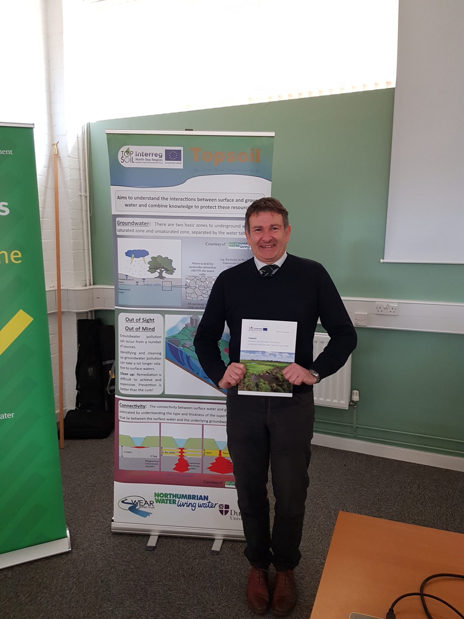
John Speed, farmer and Northern Commercial Manager, Frontier Agriculture Ltd, supports the FRW awareness campaign, leading on the subject in the Frontier Agronomy Bulletin (page 4). He comments: “I look forward to working with Wear Rivers Trust on the Topsoil project. We will be working with farmers and other partners to collect local data on innovative approaches to arable cultivation and traditional ploughing. We will compare impacts on soil health and productivity and aim to directly influence practical land management in our region by disseminating the results.”
John Speed, Frontier Agriculture Ltd, supports the FRW awareness campaign in TOPSOIL. © Wear Rivers Trust
These examples illustrate TOPSOIL’s focus on better understanding and protecting groundwater, and the wide scope of methods and approaches needed for this endeavour to succeed.
ABOUT TOPSOIL
TOPSOIL fosters joint development of methods to describe and manage the uppermost 30m of the subsurface, to improve climate resilience in the North Sea Region. Its 16 pilots explore new approaches to climate adaptation through groundwater management. The partnership includes local and regional authorities, research institutions, environmental NGOs and water providers.
- Total budget: €8.5 million including ERDF funds of €4.23 million.
- Partnership: 24 partners from Denmark, the Netherlands, Germany, United Kingdom and Belgium
- Project duration: Five years (2016 – 2021).
For an introduction, check out this video.
To learn more and contact the project, visit TOPSOIL’s website.